
Websuite Configuration
-
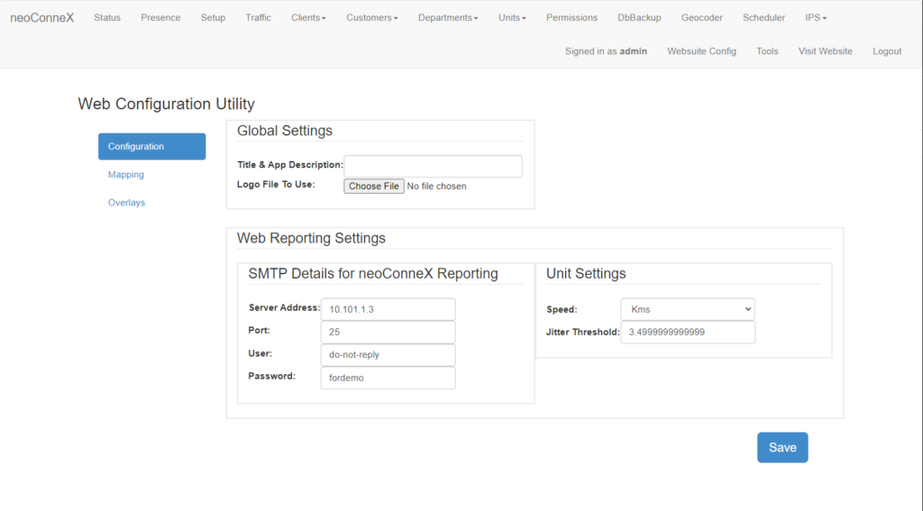
To access the page, along the top navigation go to Websuite Config.
-
The left navigation bar will show options for Configuration, Mapping and Overlays. Configuration will open by default.
-
Title & App Description – Set the title to be shown on the websuite home page.
Logo File – Select an image file to be shown on the login and web pages. Typically this is your company logo.
-
SMTP Details – Allows the user to provide simple mail transfer protocol information to be able to send out telematics reports via email. This must be configured in order for emails to be sent.
-
Speed – Choose what unit of measure is used in the web reporting application.
Jitter Threshold – Units with speed is below this level will show as stopped in the Websuite.
-
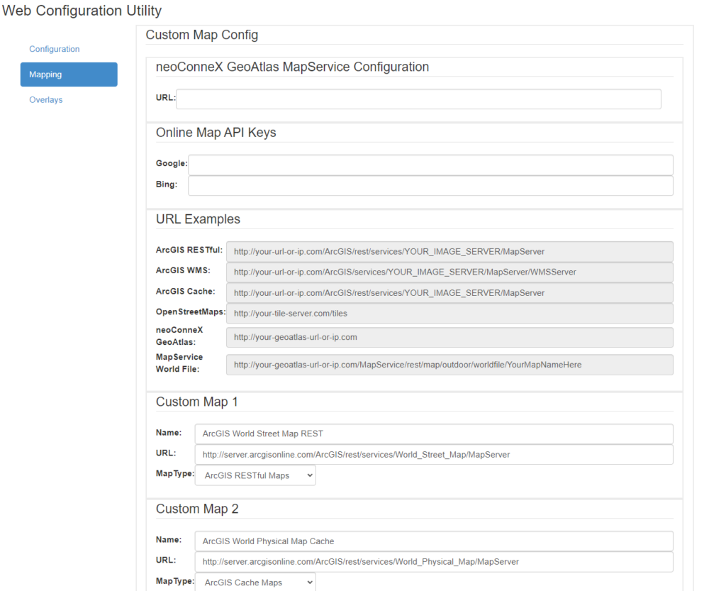
Choose Mapping to open the custom mapping configuration.
-
neoConneX GeoAtlas URL – Only used in combination with neoConneX Atlas hardware. This is the URL to connect.
-
Online Map API Keys – Enter API keys here to enable third party map providers. Currently Google Maps and Bing Maps are supported.
-
Example URL formats for various providers.
-
Custom Map 1-8 – Enter custom map details into the appropriate field and select Map Type. Remember to click on Save at the bottom of the page to save custom map details.
Currently supported custom maps include: ArcGIS RESTful, ArcGIS cached Maps, and ArcGIS WMS web services.
The mapping section allows for configuring custom mapping options.

-
Choose Overlays to open the mapping overlays options.
-
This table will show all overlays already entered into the system. They may be edited or deleted by choosing the corresponding options.
-
Press Add Overlay to open the overlay dialog. In the dialog enter the Name, URL and Map Type.
Overlays are only used when making use of a geoAtlas system.